Walk to Tsaliana
14km, 250m ascent. All on good tracks, but possible problems
with fences.
Tsaliana [Τσαλιανα] is
on the road NNW from Paleochora to Voutas
[Βουτάς]. The most pleasant way of
reaching it is to walk out of Paleochora on the Koundoura
[Κουνδουρά] road
(following the shore, West of Paleochora).
Just beyond the major headland, take the first track leading
inland (see Figure 1), shortly before the bridge (N35 14.263 E23
39.072).
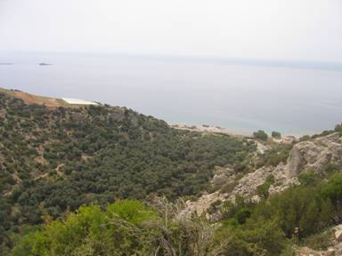
Figure 1: The valley track in from
the coast, seen from the higher track on which one returns from the
coast.
After a few metres, the track goes through olive trees and
passes a small chapel to the right (open). Follow the path up the
valley, keeping mostly right of the stream bed beside an old
irrigation channel, now superceded by black plastic pipes.
Once or twice the path disappears into the stream bed, but keep
following it until a large concrete ford crosses the stream (when I
walked it, in early May, the water flowed over the ford before
disappearing into the ground.) The track crossing the valley leads
up to fields to the right (East). Take the left hand track that
zig-zags up the Western valley side to a T junction. Left (S) is a
short cut back to the coast (see later) however, you can also turn
right (N) at a T junction to come soon to Agia Triada church, a
partially paved road and the village of Tsaliana.
Alternatively, from the ford, you can continue up the stream bed,
(rougher, with no clear path) until a definite path rises up to the
left through a steel mesh gate. This cobbled path rises steeply
past some houses to come out just south of the Agia Triada church.
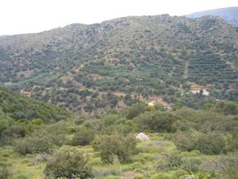
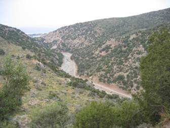
Figure 2: Agia Triada church and the track leading to it from
the South (left) seen, looking West, from the Paleochora road
across the valley
Continue north on this road to join the Voutas-Paleochora
road at the bridge (N35 15.633 E23 39.838) where bullet-ridden road
signs announce “Tsaliana”
One way back to the coast is via the road. Another rises (N35
15.460 E23 39.921) to the West of the paved road just mentioned,
between the bridge and the first house. This track zig-zags steeply
up to the West, sometimes paved in concrete, before reaching the
top of the ridge (N35 15.469 E23 39.587). Here fences may bar your
way. One track leads down to the West to a dead-end, instead follow
another along the ridge south for a while and then contours right,
before petering out. From here climb back up to the ridge, now up
to your left (East). Follow goat trails South until you see a trail
to the SW and drop off the SW side of the ridge to join it at a
ramp. The North (right) option leads you [through goat fences] into
the Pelekaniotikos river valley, past ruins and remains of an olive
press. Instead take the Southern route that climbs slightly, well
above the Pelekaniotikos. See Figure 4
Figure
4: Pelekaniotikos valley from the track South.
and then swings round the southern side of the ridge to
join up with the other branch of the tee near Agia Triada.
Before going this far though, a footpath joins from the south (N35
14.825 E23 39.221). Take this across a col, before climbing up to a
hill, and rounding this to the East side. The clear (but rough)
track then slants down towards the sea (whence Figure 1 was taken),
and swings right to join a track at a hairpin. Follow the track
down to a field, and follow the Eastern side of a fence beyond
which there are plastic greenhouses growing tomatoes. At a gap in
the fence a good trail leads down the hill to the coast road.
It’s then a 4km road walk back to Paleochora.
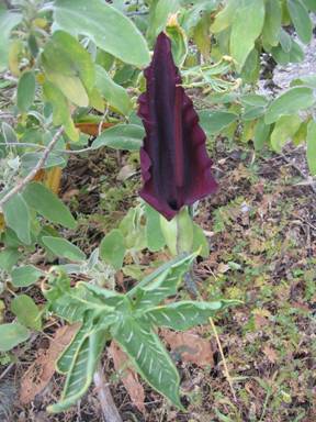
Figure 5: Dragon Lily, flowering in April/May
All pages and photographs copyright © Andrew Senior 2005 Not to be reproduced or published without permission.