Voutas to Gialos via Agia Theodori
This follows paved, but little-trafficked roads throughout. 11km
300m ascent.
Start at Voutas [Βουτάς] and take
the narrow road West from the central turn, signposted for
Elafonissi
[Ελαφονησι]. At the
next junction, there are various signs, including one for Hasi,
without an arrow. Turn left, following the valley, and after this
crosses the river, wind along the West side of the Pelekaniotikos
valley before climbing up through the (unsigned) hamlet of Hassi
(Ηασι). Continue winding West, onto the north
side of the mast-topped Hassiou Korifi
[Χασσιου
Κορυφη], with good views first to the
East and then to the North- the radar dome-topped Sklavopoula
[Σκλαβοπούλα]
(1016m).
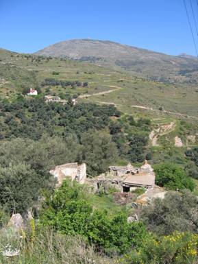
Figure 1: View north to Sklavopoula
Wind through Azogires
[Αζογυρές] (again unmarked
and not to be confused with the Azogires NE of Paleochora: N35
16.338 E23 43.176) and finally come to a staggered cross-roads
(N35 17.011 E23 37.496). 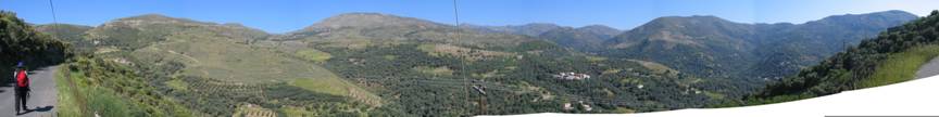
Figure 2: Panoramic view from the crossroads above
Azogires
Turn left towards the sea, rounding the West side of the Hassiou
Korifi. Soon you come to a small village, Agios Theodori (N35
16.640 E23 37.159) just above a hairpin bend. You can go through
the village on a dirt track to come to a church (N35 16.343 E23
37.277). The trail continues on a short way from there, with signs
of a footpath continuing south.
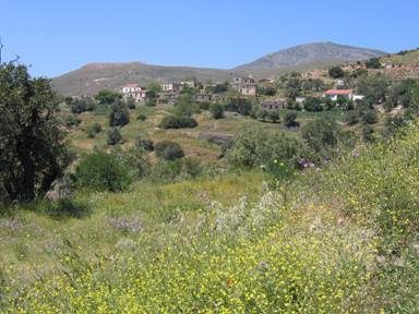
Figure 3: View of Agia Theodori from the church.
From the lower side of the Agia Theodori hairpin (N35 16.609 E23
37.139) , strike out left to cut out the next hairpin, and rejoin
the road. From here, follow the road down to Koundoura
[Κουντουρά],
occasionally being able to short cut hairpins, (e.g. at N35 15.545
E23 36.532). In Koundoura, join the road that leads back to Gialos
[Γυαλος] and Paleochora.
All pages and photographs copyright © Andrew Senior 2005
Not to be reproduced or published without permission.